Christchurch & Canterbury Spatial Intelligence • Direct Revit & ArchiCAD Integration
CANTERBURY ARCHITECTURAL PRE-DESIGN PIPELINE

Authoritative pre-design audits, built for consenting certainty.

Concept design shouldn't stall for a month waiting on a traditional survey measure-up. We deliver survey-grade 0.25m bare-earth LiDAR contours, Council 3-Waters 3.0m maintenance buffers, and 3D daylight recession planes directly into your CAD within 3 business days.

3 Days Turnaround SLA
15 Hours Saved per Project
3.0m CCC 3-Waters Buffers
AS 4970 Tree RPZ Standards
EPSG:2193 NZTM2000 / NZVD2016
HOW IT WORKS

The automated geospatial data factory.

We eliminate the 3-to-6 week surveyor backlog by combining autonomous low-altitude drone capture with automated spatial API harvesters. You get mathematically verified site constraints before putting pencil to paper.

01

Autonomous Field Flight

We deploy lightweight sub-250g DJI Mini aircraft under CAA Part 101 rules. Captures high-overlap aerial photogrammetry at sub-1.5cm ground sampling distance (GSD) across the target parcel, roof ridges, and boundary fence lines.

Equipment: DJI Mini 3/4 Pro · GSD ≤ 1.5 cm/px
02

Council & Cadastral Ingestion

Our Python pipelines query the LINZ Landonline Cadastre API (Layer 50772) for primary title lines and harvest Christchurch City Council (CCC) ArcGIS REST servers for reticulated 3-Waters mains, laterals, and Flood Management Areas (FMA).

APIs: LINZ Landonline · CCC GIS · Canterbury Maps
03

Revit & ArchiCAD Packaging

We execute statistical outlier removal and cloth simulation filters (CSF) to extract true bare-earth ground points (ASPRS Class 2). All vectors are transformed to EPSG:2193 NZTM2000 and formatted with zero coordinate-origin clipping for your CAD tools.

Exports: DXF · DWG · LAZ · OBJ · PDF Dossier
CCC DISTRICT PLAN 9.4 · AS 4970-2009 COMPLIANCE

Tree Root Protection Zoning (RPZ):
Eliminate the $2,500 arborist surprise.

In Canterbury infill developments, mature trees—whether on-site or overhanging from adjoining properties—are one of the most common causes of Council Section 92 consent halts. Ground disturbance, trenching, or foundations placed within an unmapped root zone triggers mandatory arborist assessments, consent redesigns, and months of delay.

✓
3D Drone Canopy & Trunk Photogrammetry High-density point clouds accurately extract canopy driplines, trunk diameters (DBH), and structural root flare coordinates.
✓
Automated Radial RPZ Buffers (AS 4970-2009) Mathematical calculation of the minimum Root Protection Zone (12 × DBH or Canopy Dripline + 1.0m) baked directly into your CAD layer.
✓
True Net Unencumbered Building Envelope We deduct statutory yard setbacks, CCC 3-waters pipe corridors, and tree RPZ buffers to certify the 100% buildable footprint before concept massing starts.
Inspect Tree RPZ in 3D Dashboard ↗ Standard inclusion in every $950 Audit
RPZ CONSTRAINTS MATRIX AS 4970-2009 Compliant
WITHOUT TREE RPZ AUDIT $2,500+ Arborist assessment & 6-week Section 92 consent delay
WITH GROUND SPATIAL $0 Extra Included in $950 Audit on Day 3 directly in your CAD
Canopy Dripline Buffer: Dripline + 1.0m Radius
Trunk Diameter Formula: RPZ Radius = 12 × DBH
CAD Layer Export: GT_TREE_RPZ (DWG / DXF)
Council Jurisdiction: CCC District Plan Rule 9.4.4.1
DELIVERABLES MANIFEST

Everything you need to begin preliminary concept design.

Every file is certified against official Land Information New Zealand (LINZ) geodetic control and delivered in standard 7-digit EPSG:2193 coordinates and NZVD2016 vertical elevations.
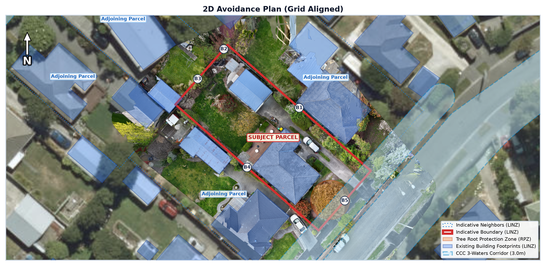
2D Avoidance Plan & 3.0m Setbacks DXF + PDF
DELIVERABLE 01

2D Avoidance & Constraint Plan

Calculates the true unencumbered buildable envelope. Isolates tree Root Protection Zones (RPZ under AS 4970-2009) and demarcates mandatory 3.0m council stormwater/wastewater maintenance clearance corridors.
Setbacks: CCC 3-Waters 3.0m · AS 4970-2009 Tree RPZ
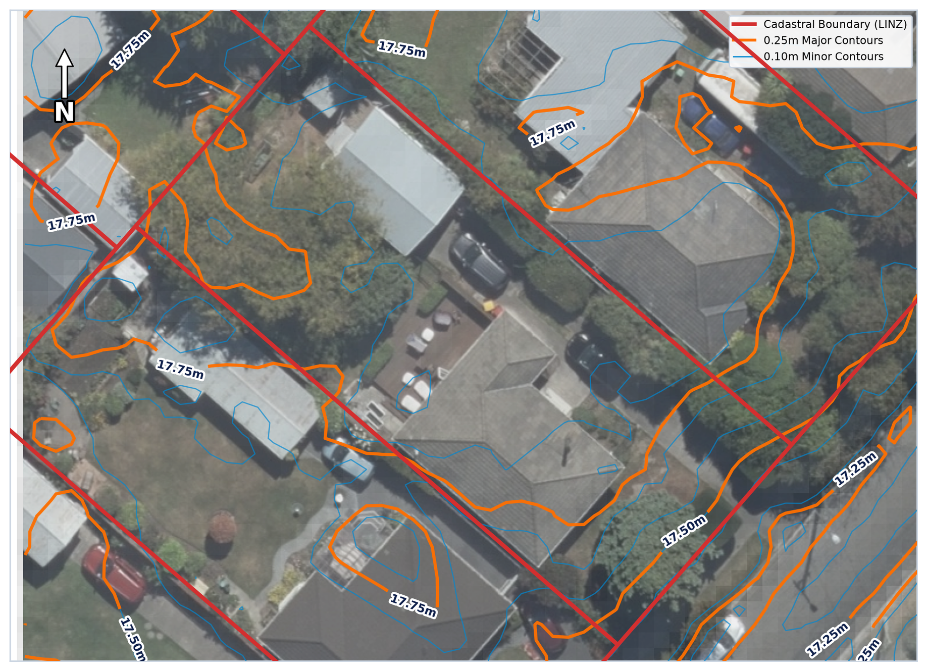
0.25m Topographic Bare-Earth Contours DXF + LandXML
DELIVERABLE 02

0.25m & 0.10m Topographic Contours

Bare-earth terrain models with all surface vegetation, fences, and temporary debris mathematically stripped away. Tied to NZVD2016 for direct cut/fill and Finished Floor Level (FFL) engineering.
Datum: NZVD2016 · 0.25m / 0.10m
3D Daylight Recession Planes (HIRB) DXF + OBJ Mesh
DELIVERABLE 03

3D Daylight Recession Planes (HIRB)

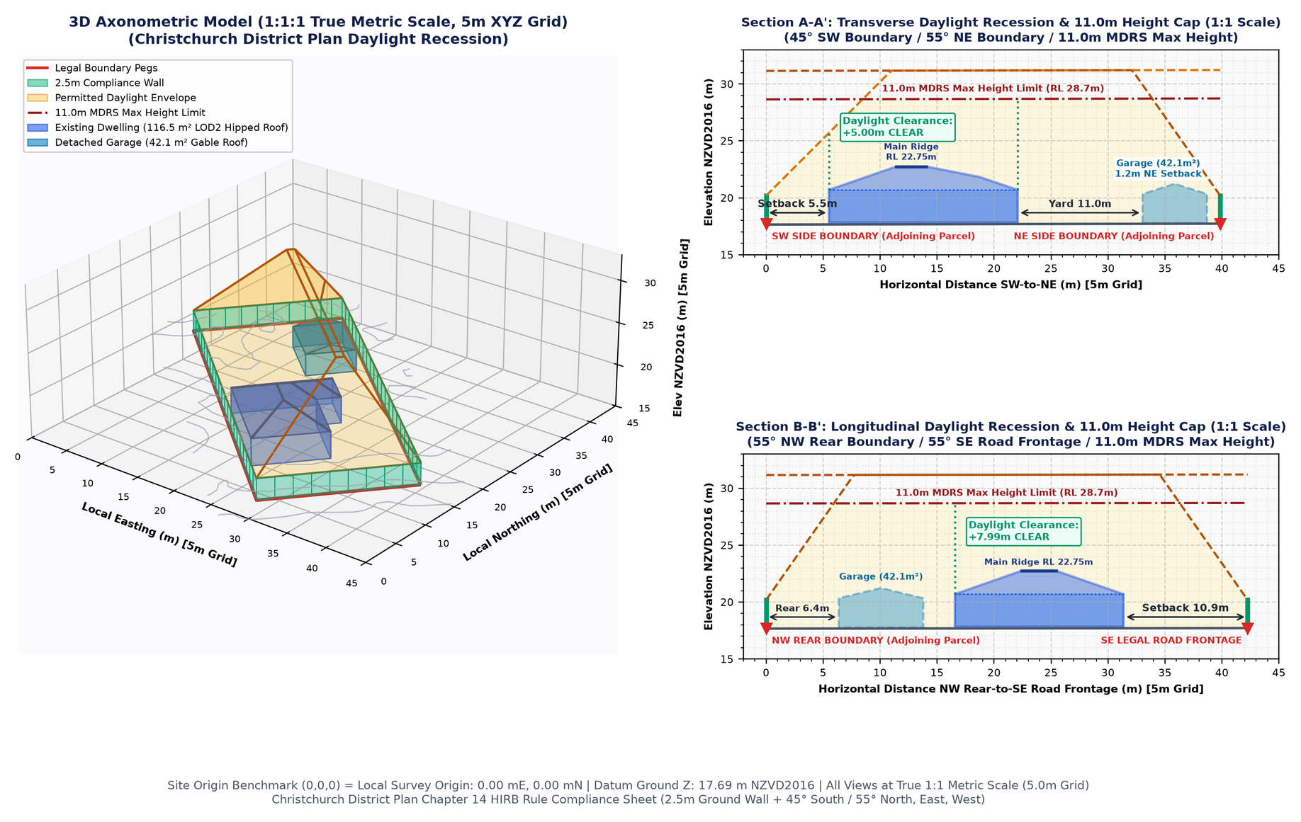
Parametric 3D hip-roof recession plane envelopes under Christchurch District Plan Chapter 14 (2.5m pin height + 45°/55° slope normals). Drops straight into Revit and Archicad to verify upper-floor envelopes.
Standard: MDRS Chapter 14 Envelopes
Sub-Centimeter Orthomosaic GeoTIFF (TIF)
DELIVERABLE 04

Sub-Centimeter Orthomosaic

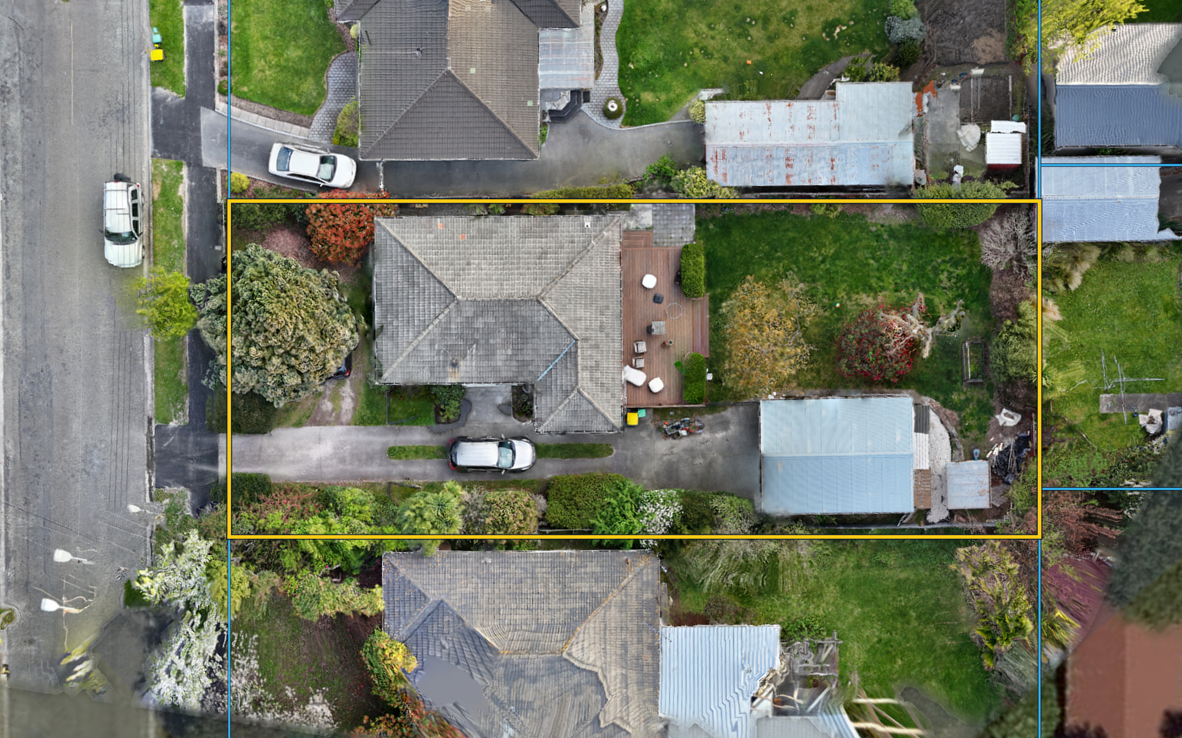
High-resolution aerial composite georeferenced against primary LINZ parcel boundaries. Confirms actual physical fence positions, driveways, garden beds, and roof eaves against legal title lines.
Resolution: GSD ≤ 1.5 cm/pixel
Winter Solstice Shadow Ray-Tracing PDF + Vector Overlay
DELIVERABLE 05

Winter Solstice Solar Ray-Tracing

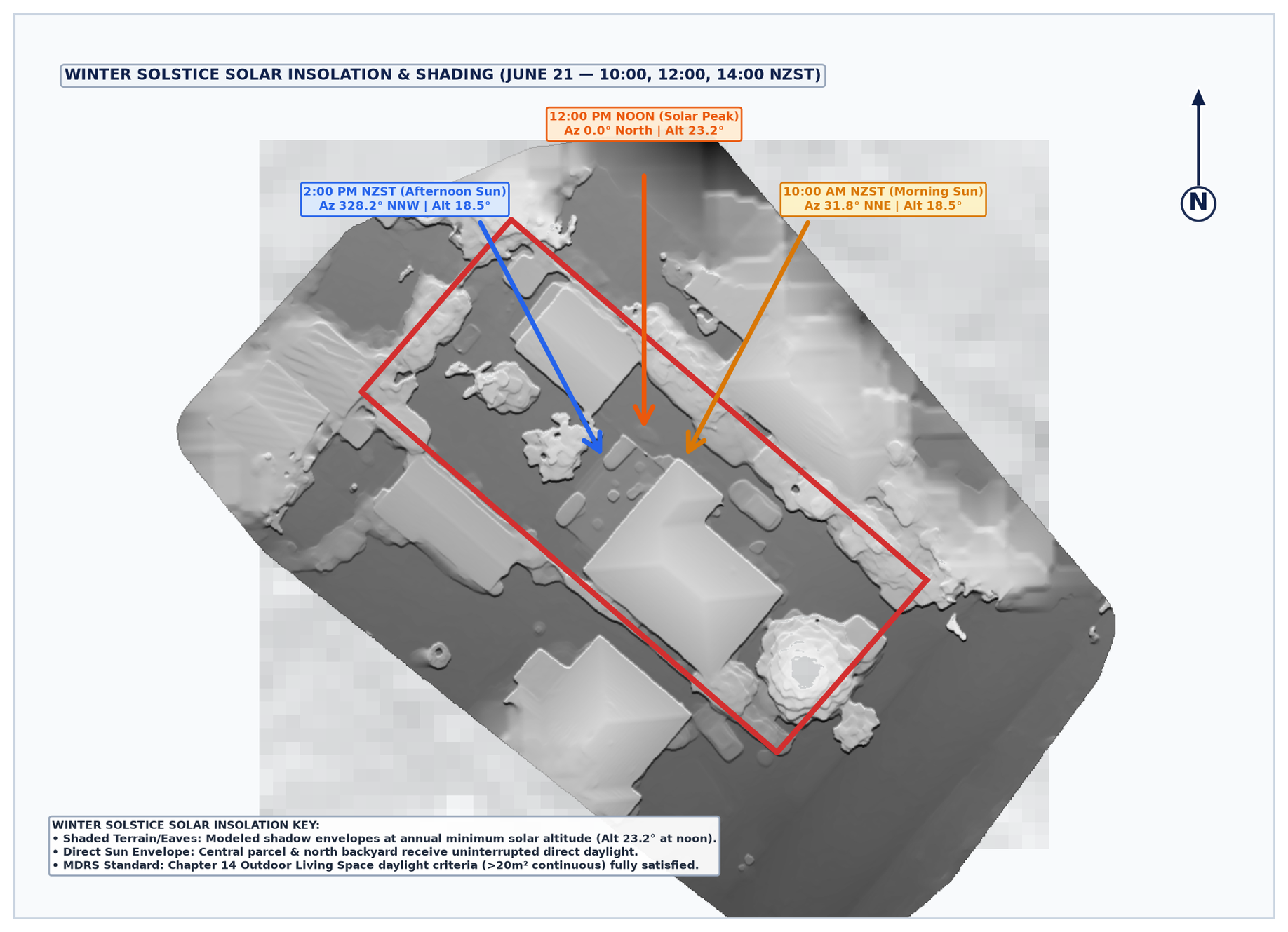
Solar ray-tracing at June 21 (Winter Solstice at 09:00, 12:00, and 15:00 NZST). Reveals exact overshadowing from neighboring 2-storey structures, mature trees, and hillside topography.
Ray-Tracing: June 21 Solar Angles
Executive 10-Page Feasibility PDF Dossier Print-Ready PDF
DELIVERABLE 06

Executive Feasibility Dossier

A comprehensive 10-page executive PDF dossier synthesizing LINZ titles, CCC 3-Waters reticulation, BeforeUdig schematic schematics, FMA flood overlays, and net buildable site statistics.

Format: 10-Page Council-Ready PDF
CHOOSE YOUR PRE-DESIGN TIER

Transparent, flat-rate audit pricing.

Select the Desktop Feasibility Audit for pre-purchase due diligence, or the Full Field Audit for preliminary concept design and consenting.

PRE-PURCHASE AUDIT 24–48 Hr Turnaround

Desktop Feasibility

Rapid due diligence before putting an offer on land or advising property developers on concept feasibility.

$450 +GST flat
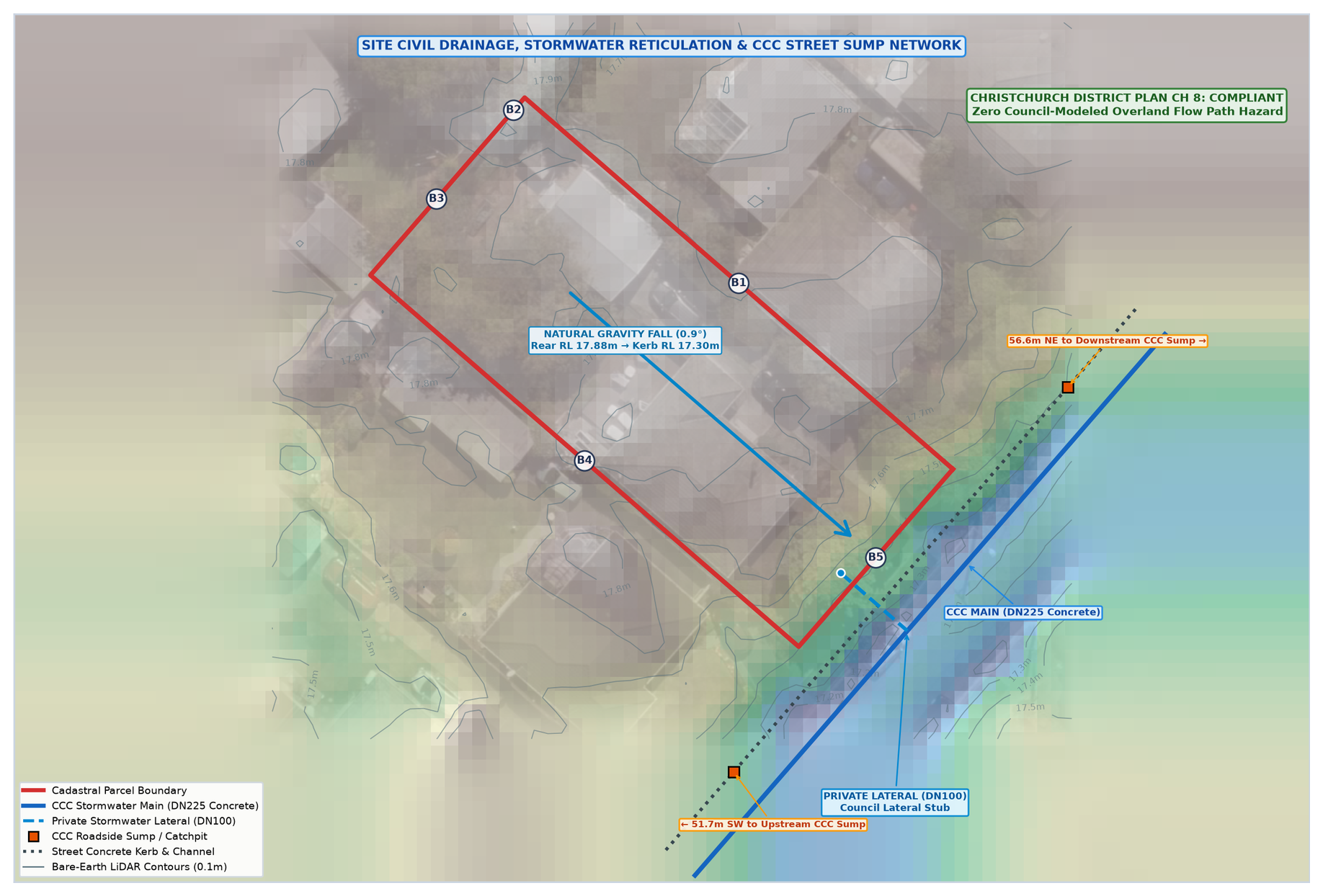
  • ✔ LINZ Landonline Cadastral Boundaries (EPSG:2193)
  • ✔ Official 1m LINZ Bare-Earth LiDAR Contours
  • ✔ CCC 3-Waters Reticulated Infrastructure Overlay
  • ✔ Statutory 3.0m Utility Maintenance Buffers
  • ✔ CCC Flood Management Area (FMA) & Hazards
  • ✔ Executive 8-Page Feasibility PDF Report
  • ✖ Physical UAV On-Site Flight
  • ✖ Sub-cm High-Resolution Orthomosaic
Select Desktop Audit ($450) →
MOST POPULAR
PRE-DESIGN & CONSENTING 3-Day SLA Guarantee

Full Field Site Audit

Complete physical drone flight, Master CAD package, and 3D recession plane point clouds.

$950 +GST flat
50% mobilization deposit on booking ($475) · Balance on CAD delivery
  • ✔ Physical On-Site Drone Flight across Christchurch
  • ✔ Sub-cm Georeferenced Orthomosaic (GeoTIFF)
  • ✔ Master Multi-Layer CAD Package (DXF/DWG)
  • ✔ 0.25m & 0.10m Bare-Earth Contours (NZVD2016)
  • ✔ 3D Recession Plane (HIRB) Hip-Roof CAD Meshes
  • ✔ Certified 3.0m CCC 3-Waters Avoidance Buffers
  • ✔ Winter Solstice Solar Ray-Tracing (June 21)
  • ✔ Executive 10-Page Council-Ready PDF Dossier
Book Full Field Audit ($950) →
Statutory Boundary Status & Subsurface Utility Notice (Cadastral Survey Act 2002)

1. Indicative Planning & Feasibility Data: Ground Spatial NZ provides spatial constraint modeling, environmental due diligence, and preliminary architectural site intelligence. All boundary vectors are harvested from the Land Information New Zealand (LINZ) Landonline digital cadastral database (Layer 50772) and represent indicative planning boundaries only.

2. No Cadastral Survey Certification: Deliverables provided under this service do not constitute a Cadastral Survey as defined under the New Zealand Cadastral Survey Act 2002. Ground Spatial NZ does not undertake legal boundary pegging. Physical boundary certifications and formal boundary dispute resolutions must be verified by a Licensed Cadastral Surveyor (LCS) prior to physical foundation concrete pours.

3. Underground Utility Mapping: Council 3-Waters stormwater, wastewater, and water mains data, as well as BeforeUdig (BYD) records, represent public-record schematic locations harvested via municipal APIs. Ground Spatial NZ disclaims all physical liability for unmapped, deviated, or undocumented private laterals. Non-destructive hydro-excavation (potholing) must be executed by civil contractors prior to mechanical excavation.

INSTANT CLIENT BOOKING

Order Pre-Design Site Clearance Audit

Lock in your site address and legal appellation. We immediately verify Christchurch / Canterbury airspace and initiate LINZ cadastral parcel extraction.

Full Field Site Audit: $950+GST flat rate. Guaranteed 3-day turnaround.