Architectural Due Diligence & Site Clearance Benchmark
A typical Canterbury 701.6 m² residential parcel illustrating our rapid pre-design audit pipeline. Demonstrating how architectural teams resolve legal boundaries, tree protection zones, 0.25m bare-earth LiDAR contours, and Council 3-Waters clearance before spending $12,000 on concept massing.
4-Week Survey Backlog
Traditional licensed surveyors quoted a 4–6 week wait time and $3,500 fee just to establish preliminary spot heights and fence offsets. Design had completely stalled.
72-Hour Rapid Audit
Ground Spatial executed an autonomous RTK photogrammetry flight, integrated LINZ Landonline Layer 50772 cadastre, and harvested live CCC GIS 3-Waters reticulation.
Zero Section 92 RFIs
Architect received 0.25m bare-earth contours, 3D HIRB daylight tent, and 3.0m utility buffers in Revit on Day 3. Resource consent approved on first council submission.
10-Deliverable Asset Manifest
Click any deliverable to preview high-resolution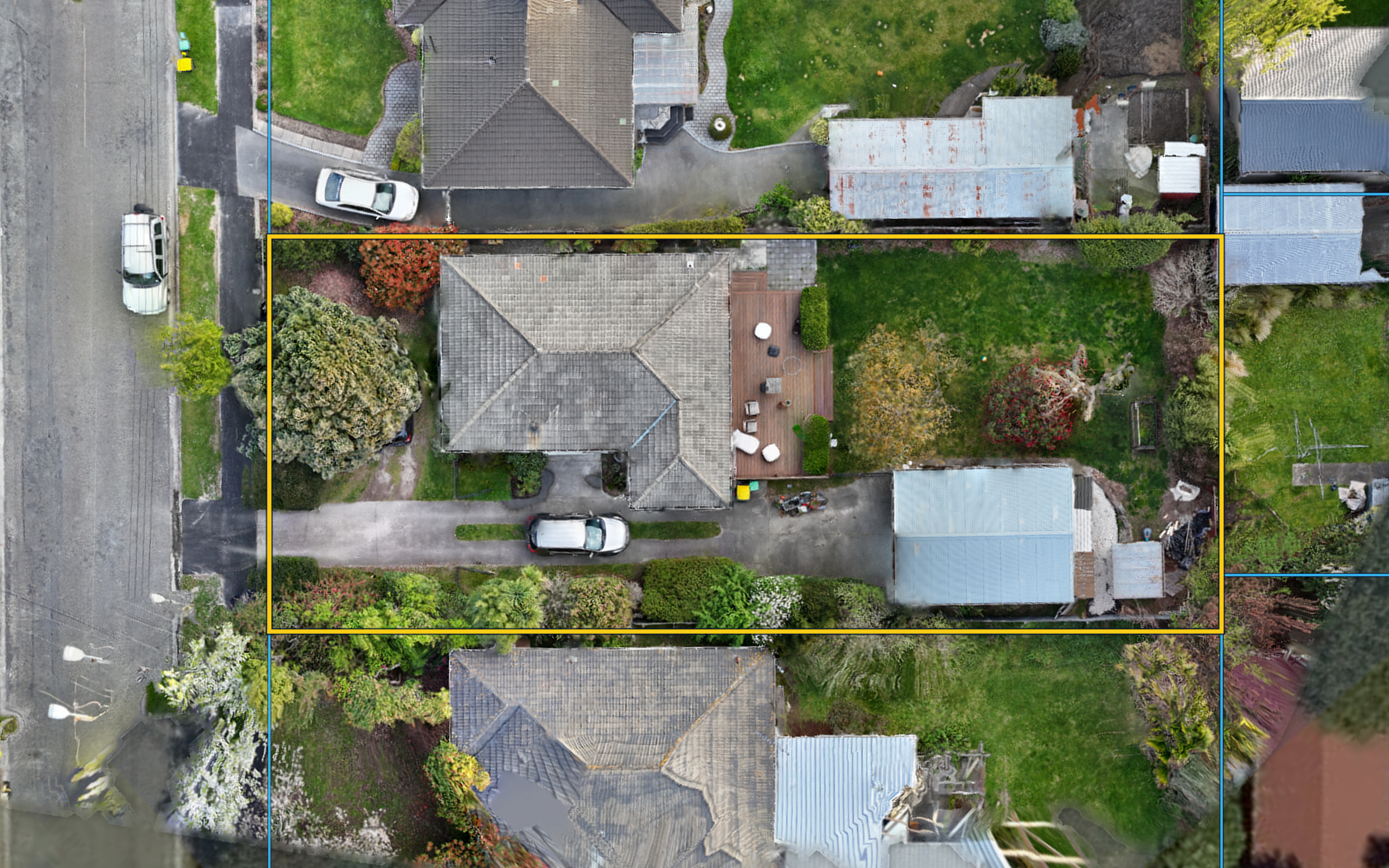
Sub-Centimeter Orthomosaic
True-scale aerial photogrammetry overlaid with authoritative LINZ primary parcel boundaries. Proves fence lines against legal title.
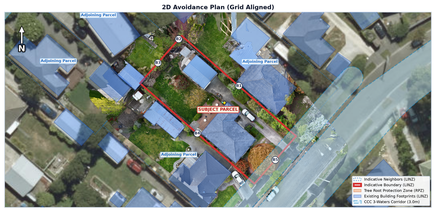
2D Avoidance & Constraint Plan
Isolates unencumbered buildable platform (540.9 m² / 77.1%), tree Root Protection Zones, and statutory 3.0m council utility buffers.
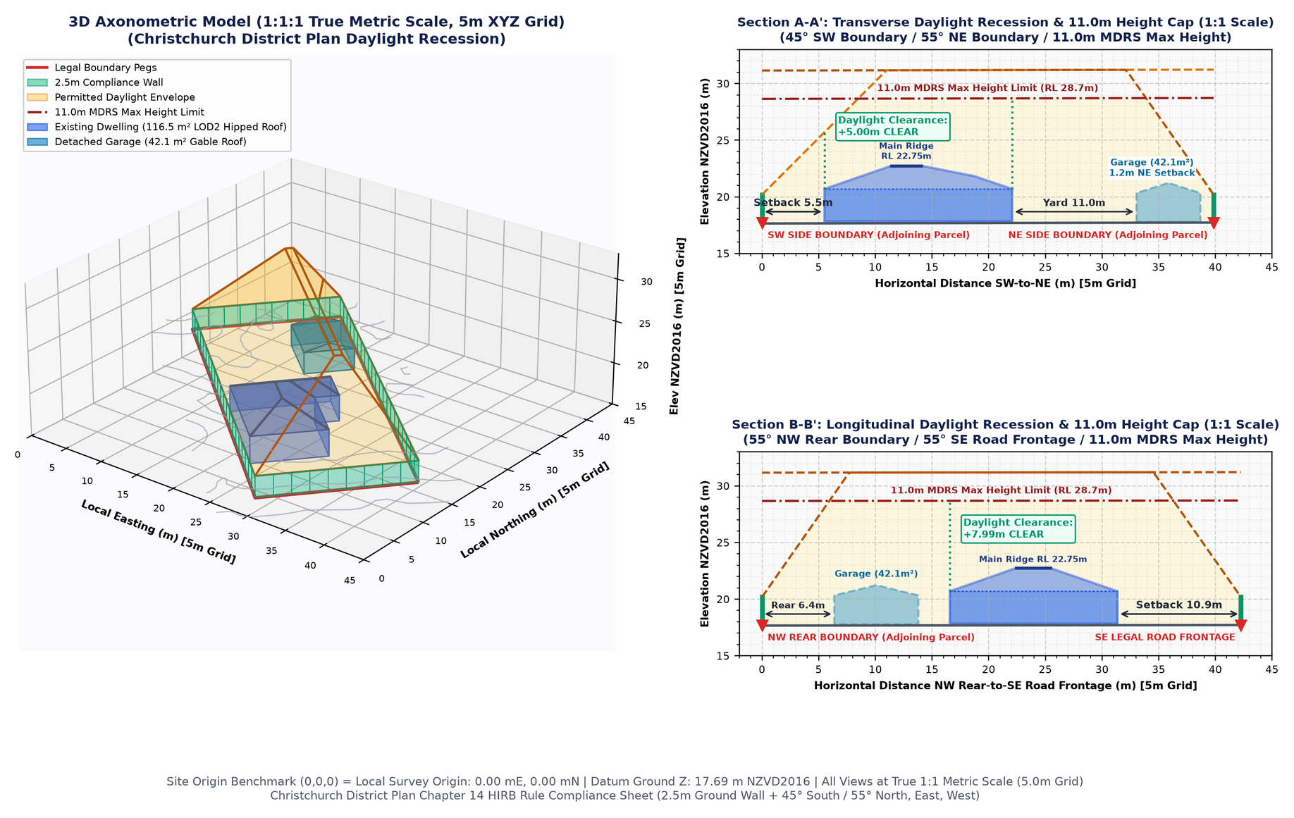
3D Daylight Envelope (HIRB)
Parametric 3D recession planes and 11.0m MDRS height ceiling under Christchurch District Plan Chapter 14 (45° south, 55° north).
Want to inspect the complete 10-page Burnside audit?
Download the actual client deliverable: 0.25m bare-earth LiDAR contours, Council 3-Waters schematics, and solar ray-tracing analysis.