1. The Statutory Constraint: Christchurch's 3.0-Meter "Building Over" Rule
In Christchurch’s brownfield and infill development sectors—especially high-density residential developments in Merivale, St Albans, Burnside, and Linwood—subsurface infrastructure is frequently the single largest determinant of net usable land area.
Under the Christchurch City Council (CCC) Water Supply, Wastewater and Stormwater Bylaw 2014 and Chapter 8 (Infrastructure) of the Christchurch District Plan:
When an architectural practice designs a building footprint without accounting for these exact clearances, council planning and engineering officers issue a formal Section 92 Request for Further Information (RFI). This triggers immediate consequences:
- Statutory Clock Pause: Council halts the 20-working-day processing clock for your resource consent or building consent.
- Structural Redesign Fees: The structural engineer must design concrete grade beams, pile bridging details, or sacrificial encasement to protect council reticulation.
- Yield Loss: In severe infill scenarios, an entire townhouse or carpark bay must be removed from the masterplan after client signoff.
2. Why Indicative GIS Tracing & BeforeUdig PDFs Fail in CAD
Many design teams attempt to resolve utility constraints during concept feasibility by taking screenshot snips of the CCC Canterbury Maps GIS viewer or referencing BeforeUdig utility plans. While useful for broad orientation, this workflow carries significant legal and geometric risk:
- Non-conformal raster distortion when scaled in CAD.
- No coordinate reference system (CRS) tie-in.
- Ignores pipe depth, material, and structural surcharge angles.
- Zero automated intersection with LINZ cadastral legal boundaries.
- Vector geometry queried live from authoritative CCC REST APIs.
- 100% native EPSG:2193 (NZTM2000) metric coordinates.
- Mathematical Shapely 3.0m Minkowski buffer polygons.
- Direct export to DXF/DWG layers for drag-and-drop Revit/ArchiCAD import.
3. The Algorithmic Resolution: Live CCC APIs & Python Shapely Buffering
Ground Spatial automates the constraint extraction process through our dedicated geospatial ETL pipeline. Instead of relying on manual drafting, our pipeline executes an automated script upon site commissioning:
import shapely.geometry as geom
from shapely.ops import unary_union

# 1. Ingest CCC 3-Waters vector pipes in EPSG:2193
storm_mains = fetch_ccc_feature_layer("Stormwater_Gravity_Main", parcel_bbox)
waste_mains = fetch_ccc_feature_layer("Wastewater_Gravity_Main", parcel_bbox)

# 2. Compute 3.0m statutory avoidance buffers
storm_buffer = unary_union([pipe.geom.buffer(3.0, cap_style='round') for pipe in storm_mains])
waste_buffer = unary_union([pipe.geom.buffer(3.0, cap_style='round') for pipe in waste_mains])

# 3. Intersect with LINZ Primary Cadastral Parcel
net_buildable_envelope = parcel_polygon.difference(storm_buffer).difference(waste_buffer)
Every public reticulation feature is classified into standard CAD layers that plug directly into your practice’s template:
GT_CCC_STORMWATER_MAIN: Authoritative pipe centerline with invert level and pipe diameter metadata.GT_CCC_STORMWATER_BUFFER_3M: 3.0m offset zone highlighting statutory building exclusion areas.GT_CCC_WASTEWATER_MAIN: Council foul sewer alignment.GT_CCC_WASTEWATER_BUFFER_3M: 3.0m wastewater exclusion envelope.GT_NET_BUILDABLE_ENVELOPE: Resultant unencumbered building footprint after applying council utility and boundary setbacks.
4. Real-World Case Study: Infill Site Clearance in Christchurch
Below is a high-resolution feasibility constraint audit generated for a residential development in Christchurch. In this project, an unmapped stormwater main traversed diagonally across the western section of the parcel:
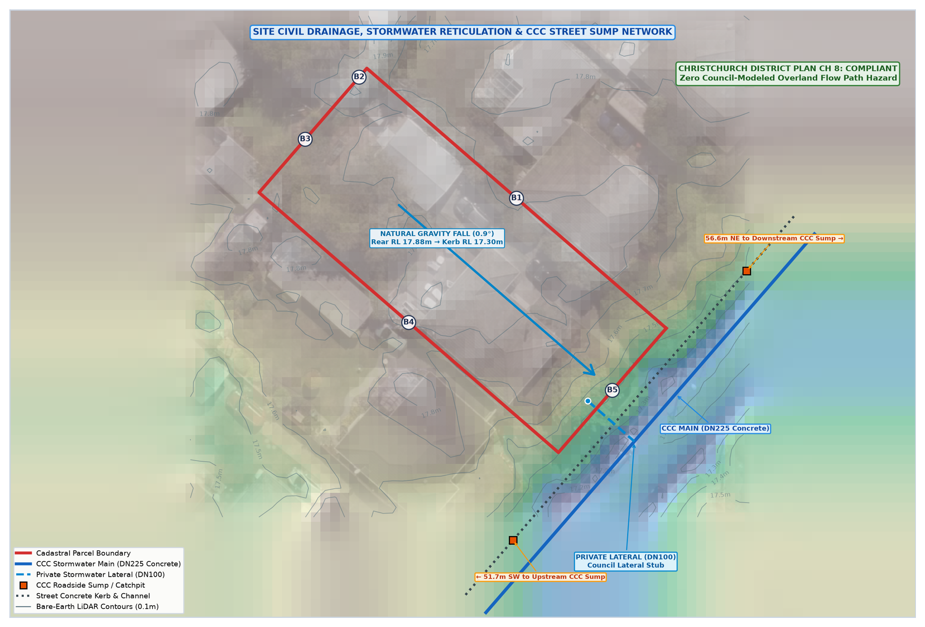
By catching this constraint on Day 2 of concept design, the architectural team shifted the building footprint 3.4 meters east, entirely avoiding the council stormwater main.
This eliminated the need for driven piles, council bridging consent, and a Section 92 consent review—saving an estimated $14,500 in engineering and consent delays.
5. Architectural Due Diligence Checklist for Christchurch Infill
Before laying down initial building massing on your next Christchurch site, ensure your team completes these four verification gates:
- Verify Public vs. Private Status: Confirm whether any pipe crossing the property is a public CCC asset or an unmapped private shared lateral (BeforeUdig does not map private drains).
- Extract True Pipe Inverts: Determine the depth of the pipe. If the invert is deeper than 1.5m, foundation loads must be checked against the 45° angle of repose.
- Reconcile Surface Drone Evidence: Check aerial orthomosaics for manholes, sumps, and inspection eyes that do not match council GIS lines.
- Import Native EPSG:2193 Contours & Buffers: Never scale raster images into CAD. Always use vector DXF geometry tied to New Zealand Transverse Mercator 2000.