1. The Fine Print Nobody Reads on BeforeUdig Reports
Every architect and project manager in New Zealand knows to pull a BeforeUdig inquiry before groundworks begin. It is standard practice and required by health and safety plans.
What many design teams overlook is the legal disclaimer stamped on every page returned by utility operators:
In practical terms, the moment a public service crosses the legal boundary line onto private land, it disappears from utility records. The council maps their trunk main in the road reserve, but the 100mm sewer lateral or the private stormwater soak pit connection in the backyard simply does not exist in the database.
If your design assumes clean ground because the BeforeUdig report returned no colored lines across the building platform, you are taking an unverified gamble with client capital.
2. Why Canterbury Infill Sites Carry Triple the Subsurface Risk
Working on infill sites in Christchurch presents distinct challenges compared to greenfield developments in Rolleston or Selwyn:
A. Undocumented Post-Quake Rerouting
During the emergency rebuild era across suburbs like St Albans, Richmond, and Sydenham, ruptured earthenware pipes were bypassed with flexible uPVC connections. In hundreds of cases, these replacement runs took shortcut routes across driveways and garden beds instead of following the original historical easements. As-built plans were frequently lost or never formally submitted to council records.
B. Shared Cross-Lease Drainage Runs
Older multi-unit properties and cross-lease subdivisions frequently share private drainage networks. A neighbouring house's foul sewer might run straight across the corner of your client's parcel before connecting to the council main in the street. Hitting that pipe during piling creates an immediate sewage emergency, contractor stand-down costs, and dispute liabilities.
C. High Groundwater and Surcharge Pressure
Across eastern and central Christchurch, groundwater often sits within 1.0 to 1.5 meters of natural surface level. Striking a live pipe during screw piling or strip footing excavation does not just cause a clean leak; it quickly floods the excavation trench, collapses trench sidewalls, and requires immediate dewatering consents.
3. How Drone Photogrammetry Catches What GIS Misses
Pipes run underground, but they almost always leave physical clues on the surface. Traditional ground survey teams often miss subtle surface details when surveying with a single GNSS rover pole taking point shots every 10 meters.
Ground Spatial approaches site clearance through high-density photogrammetric reality capture. Flying at 45 meters altitude with calibrated RTK positioning produces an orthomosaic with a ground sampling distance (GSD) under 18 millimeters per pixel.
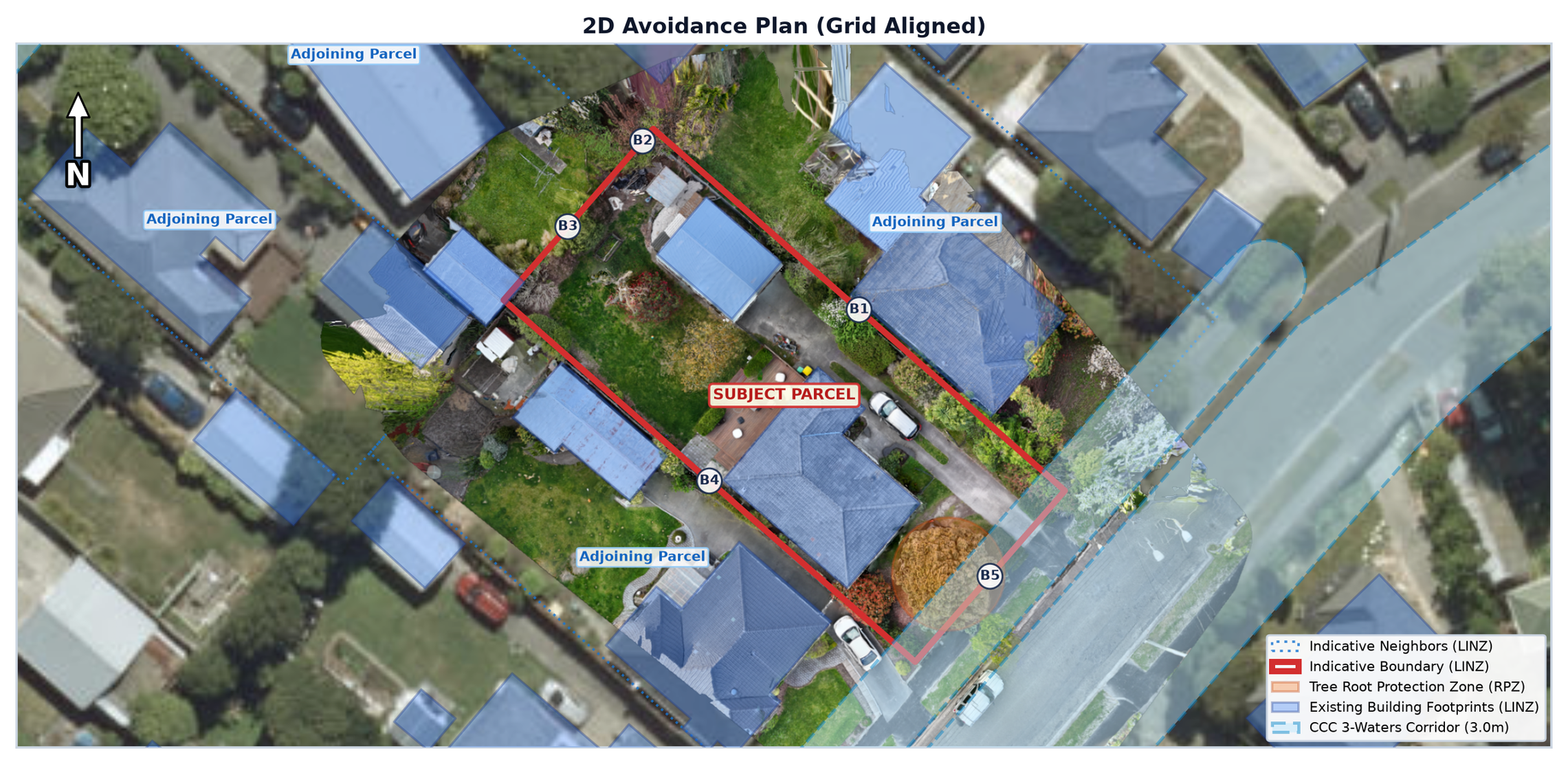
At this resolution, our feature extraction pipeline isolates:
- Inspection Eyes (IE) and Cleaning Rod Eyes: Pinpoints where private drainage branches change direction or exit building slabs.
- Council Boundary Tobies and Water Meters: Identifies the exact point of entry for council pressurised water mains, showing where incoming lines run to the dwelling.
- Stormwater Sumps and Soakhole Gratings: Confirms whether on-site detention systems actually exist or if roof runoff discharges straight into the kerb.
- Trench Settlement Depressions: Subtle linear depressions in turf and asphalt indicate where past service trenches settled over uncompacted backfill.
4. Reconciling Surface Ironwork with LINZ Legal Cadastre
Finding a manhole lid on an aerial photo is helpful, but it only becomes legally actionable when tied into Land Information New Zealand (LINZ) cadastral boundaries in EPSG:2193 (NZTM2000).
Ground Spatial reconciles these layers into a single vector drawing:
Layer 01: LINZ Primary Parcel Boundary (Legal boundary pegs & easements)
Layer 02: CCC Public 3-Waters Reticulation (Mains, inverts, council sizes)
Layer 03: Field Surface Evidence (Manholes, Toby valves, inspection eyes)
Layer 04: Interpolated In-Ground Corridors (Surface ironwork matched to mains)
Layer 05: Net Usable Building Envelope (All statutory and physical buffers applied)
When an architect drops this DXF into their CAD template, they do not see vague colored zones. They see the exact legal boundaries, the council public pipes, and verified vector paths indicating where private services connect. If a proposed garage foundation sits directly over an identified lateral run, the problem is resolved on screen in 10 minutes, rather than on site with an excavator idling at $180 an hour.
5. The Pre-Design Protocol for Christchurch Architects
To protect your practice from unmapped utility liabilities, adopt this four-point protocol for every new project:
- Pull BeforeUdig for the Road Reserve: Use BeforeUdig to establish where the main network feeds originate in the street corridor.
- Commission a High-Resolution Aerial Asset Audit: Have the site captured with RTK drone imagery to catalog all physical ironwork on site before demolition or site clearance.
- Cross-Check Council Property Files: Check historical drainage cards lodged with Christchurch City Council against physical lids visible in the drone imagery. Look for discrepancies.
- Lock the Buildable Envelope into CAD on Day 1: Design within verified constraint boundaries. Never hand off a preliminary building footprint to an engineering consultant until underground avoidance corridors are clearly resolved.